![Severe Weather Threat for Southern Portion of Tri-State [MAP]](http://townsquare.media/site/76/files/2020/03/thunderstorm.jpg?w=980&q=75)
Severe Weather Threat for Southern Portion of Tri-State [MAP]
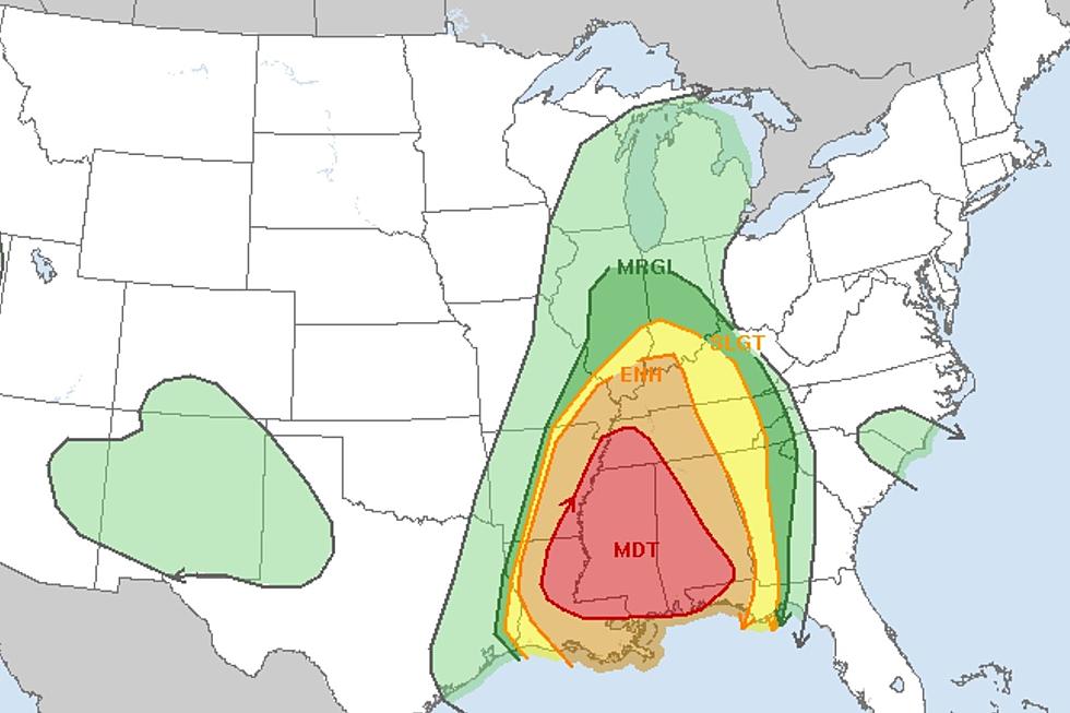
The National Weather Service has the southern portion of the WBKR listening area under a Level 2 Slight Risk for severe weather.
There is currently a severe thunderstorm watch for the following Kentucky counties:
SEVERE THUNDERSTORM WATCH 158 IS IN EFFECT UNTIL 600 PM CDT
FOR THE FOLLOWING LOCATIONS

KYC007-033-035-039-047-055-075-083-105-107-139-143-145-157-177-
219-221-032300-
/O.NEW.KWNS.SV.A.0158.200503T1645Z-200503T2300Z/

KY
.    KENTUCKY COUNTIES INCLUDED ARE

BALLARD              CALDWELL            CALLOWAY
CARLISLE             CHRISTIAN           CRITTENDEN
FULTON               GRAVES              HICKMAN
HOPKINS              LIVINGSTON          LYON
MARSHALL             MCCRACKEN           MUHLENBERG
TODD                 TRIGG
The National Weather Service's Storm Prediction Center has put counties along the Ohio River in Kentucky and Indiana under a Level 1 Marginal Risk for severe weather this afternoon.
National Weather Service
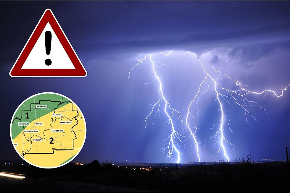
Here's what the NWS Paducah office is expecting with this severe weather threat:
A line strong to severe storms with the potential to produce
damaging winds and large hail will move across southern portions
of southeast Missouri, far southern Illinois, and southern
portions of western Kentucky this afternoon. Locally heavy
rainfall and lightning can also be expected with any thunderstorms
today.

Enter your number to get our free mobile app
KEEP READING: See how animals around the world are responding to COVID-19
More From WOMI-AM
![Severe Storms Tear the Roof Completely Off Indiana Church [PHOTOS]](http://townsquare.media/site/71/files/2023/03/attachment-St-Joe-Damage-South-Face-02.jpg?w=980&q=75)